
Hiking and Trekking in Los Nevados National Park Colombia
- Apr 23, 2022
- 9 min read
Explore the many options for hiking in this off-the-map national park featuring some of Colombia’s tallest volcano peaks. This guide will take you from start to finish on what you can expect and how you can plan a trip yourself.
About Los Nevados National Park
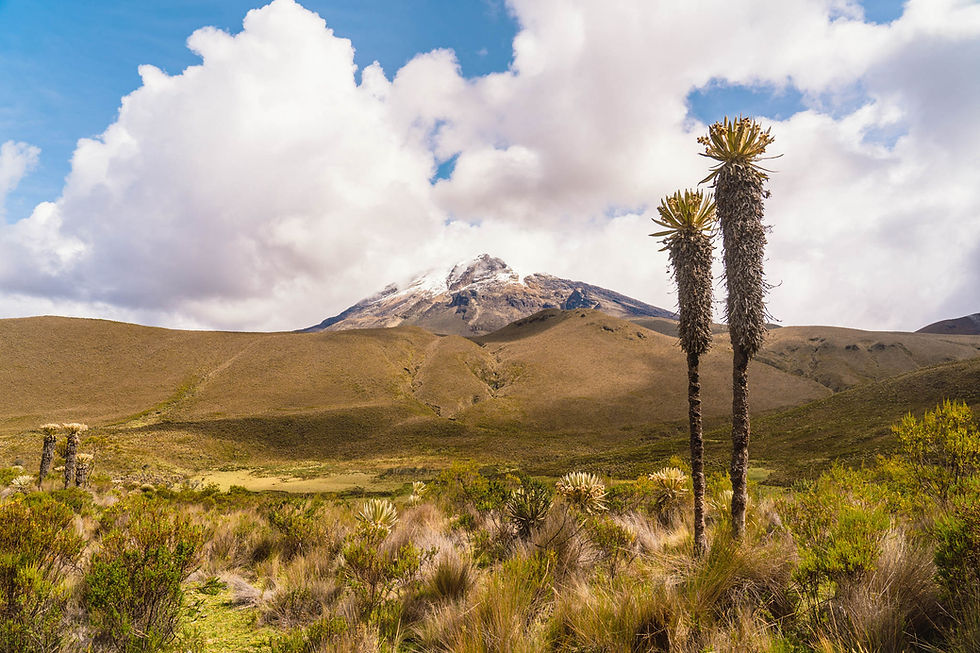
The park is located in central Colombia and is part of the Colombian Andes Mountain Range. It is a volcanic area with the most notable being Nevado del Ruiz, Nevado del Tolima, and Nevado de Santa Isabel.
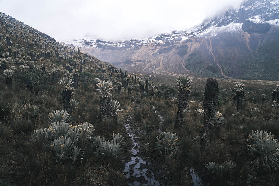
These stratovolcano’s rise between 16,000 and 18,000 feet and are home to the last three glaciers in the park which have been receding rapidly. It is expected that by 2030-20240 the smaller two glaciers will be completely gone.
The park has signs in places which show where the glaciers stood at which year and it’s quite unbelievable to be standing where a glacier reached twenty years ago and have no snow in sight.
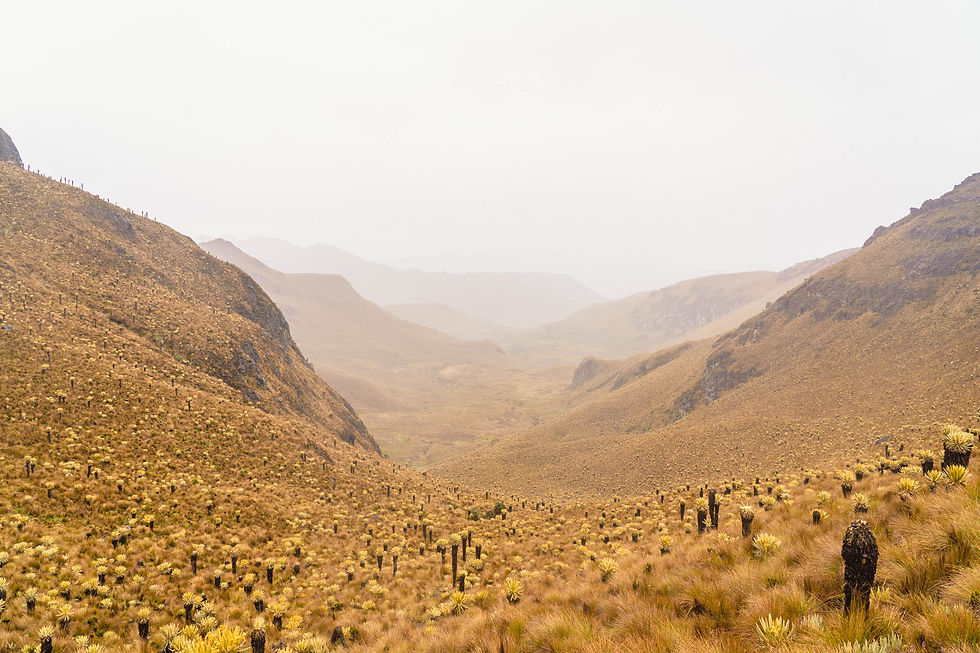
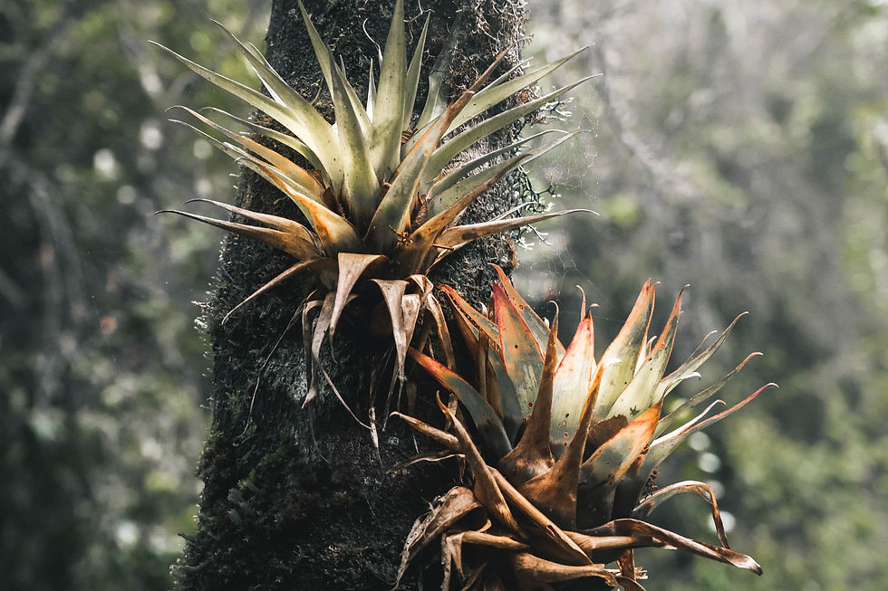
The lower elevation of the park is made up primarily of sparse vegetation, wetlands, Andean Forest, and of course plenty of Espeletia (commonly known as frailejones) which are a Martian looking shrub in the same family as sunflowers.
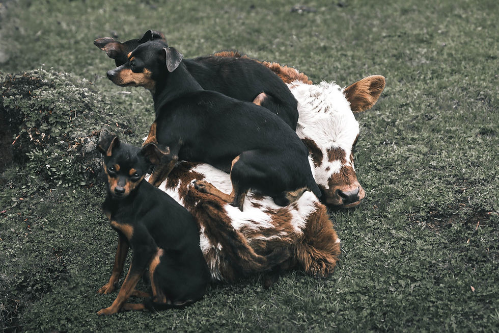
The park is also home to some incredible fauna with several beautiful types of parrots, parakeets, and the grandest of the Andes birds, the Andean Condor. Mammals that you likely won’t encounter but are well-known in the park are the Andean Bears, Andean Tapirs, and Cougars.
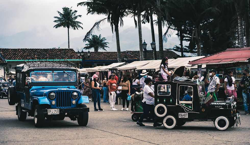
There are multiple entrances into Los Nevados National Park, however only one area has roads that can be used instead of hiking trails. The entrance typically depends on where you are trying to get to in the park but for almost all self-guided experiences, Salento/Cocora Valley will be your starting point.
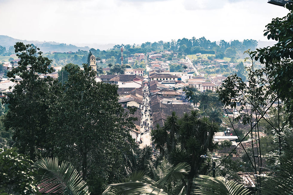
Traveling to Salento
With Salento being a top destination for domestic and foreign tourists there are plenty of daily buses and flights to the region. Below you can see the comparison of bus vs. flight from Medellin which is similar to Bogota.
If you are further than Bogota and Medellin, definitely consider flying or adding a stop on your way to break up the travel.
Medellin - Bus
Time: 8 Hours
Cost: 20 USD
Departs: Terminal del Sur (South Terminal, Medellin also has a popular North Terminal)
Company: Flota Occidental
Medellin - Flight
Time: 45 Minutes
Cost: 40 USD
Departs: MDE - PEI
Airline: Easyfly
Salento does not have an airport so flying to nearby Pereira is the most convenient flight destination. From there it’s a 15-mile drive which can be done via bus or cab for cheap.
Hiking Options from Salento - Day Hiking
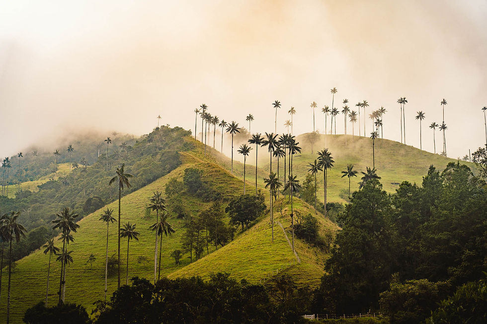
Valle de Cocora Loop
This is the quintessential hike to see the wax palms and gets a good mix of pastures, jungle, and wax palm views. It is said to be done best counter-clockwise and to wait at the second half for the clouds to disperse if doing so in the morning.
This trail has plenty of muddy sections, elevation gain, and difficult terrain like most hiking trails in the region so come prepared for a real adventure. The total distance is 6.4-miles and will take about 4 hours to complete.
Consider heading a little bit further uphill before taking the split off towards Finca la Montana to see the House of the Hummingbirds.
Casa de los Calibries (House of The Hummingbirds)
This is a lively stop at a hut serving food and tea with the beauty of endless Hummingbirds stopping by while you relax on the patio. It’s accessed by a short side trail off of the Cocora to Estrella de Agua Trail which can be done as an out and back from Cocora (6.6-miles) or added into the Valle de Cocora Loop for about an extra mile of hiking.
The entrance is around 10,000 COP to stop in and includes a complimentary cup of tea.

Hiking Options from Salento - Multi-Day Hikes
Paramillo del Quindo
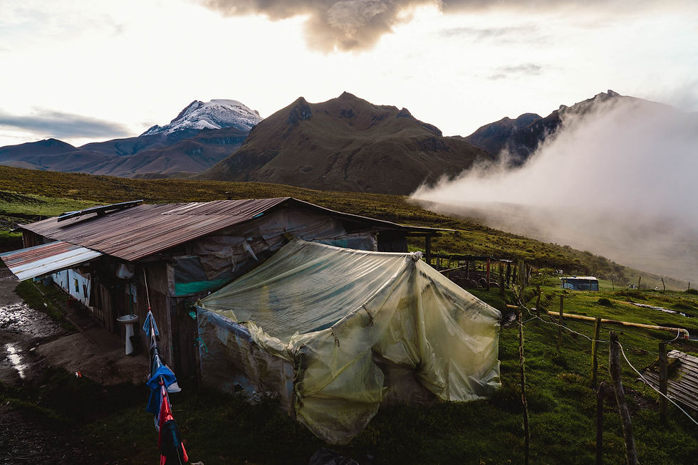
This 15,617-foot mountain peak is one of the best self-guided hikes you can do in Los Nevados. Most accessible from the Finca la Playa or Finca Buenos Aires huts, this peak will take you into the heart of Los Nevados.
An overnight at one of the previously mentioned huts will be your best bet and then plan to spend all day hiking using an out-and-back or loop and can even choose to spend another night at the same or another hut.
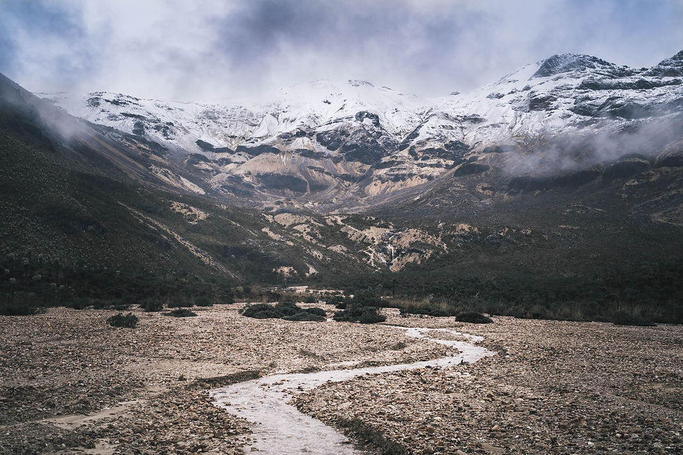
Paramillo del Quindo has a unique summit with a sandy spine that was created from glacier erosion. It wasn’t long ago that this peak was covered in snow year-round, now the peak is only covered on the occasional snowfall which happened when I attempted to climb.
A mix of bad conditions and unable to keep the trail in the snow had me turnback only a couple hundred meters from the summit. The trail should be much easier to follow in months when there is more crowd and no snow but expect steep elevation and thin air from the altitude.
Termales del Cañon
You can expect plenty of views on your hike to these hot springs at a mountain hut but the hot springs themselves are a bit lackluster. It’s muddy brown water next to grazing farm animals and with no other hikers in sight I passed on this but looked out from the mirador above.
The closest hut to start your hike from is Finca la Playa. You can use a loop to hike out here or do an out-and-back. Staying at Termales del Cañon is also an option. The loop I used approached the Nevado del Tolima base camp before veering left and traversing down to the hot springs.
Nevado del Tolima Summit Trip (Guided only)
At 17,310 feet this is the second highest peak in Los Nevados and the sixth highest in Colombia. It’s a stratovolcano with a glacier summit that will require a guide and ice climbing and glacier travel equipment so is not suitable to most as a self-guided option.
Guided trips are usually for at least four days which would look something like this:
Day 1: Hike from Cocora Valley to Finca La Playa
Day 2: Hike from Finca La Playa to Base Camp
Day 3: Summit Nevado del Tolima and return to Base Camp or lower
Day 4: Hike out to Cocora Valley
A fun fact of this climb is that one of my friends I met hiking the Appalachian Trail did this climb years back to get in the Guinness Book of World Records for the worlds highest altitude golf shot and successfully summited and evidently left a little trace from his shot off the top. Check out his Youtube here!
My Experience
I chose to do a self-guided 3-Day 2-Night adventure through Los Nevados staying at Finca La Playa and hiking near many of the spots mentioned above.

Where to Stay and Eat in Salento
I’m not going to pretend to be an authoritative source on the entirety of Salento however a couple things that were recommended to me that I enjoyed I’ll pass along here.
Viajero Hostel Salento – definitely the top-rated hostel in town, great atmosphere and plenty of good rooms to book including privates with balconies that look out to the coffee hills.
The staff are very helpful, accommodating, and knowledgeable so it was great to chat with them regarding any tours and transportation plans. I was also able to securely store my belongings that I didn’t need while hiking in Los Nevados which was important to me.
Brunch de Salento – Awesome place to eat with a full menu of delicious options. Well-known favorites with the perfect Colombian influence perfect for any meal of the day.
What’s also great is they will do packed lunches for your day out hiking or travelling. You won’t regret having a packed lunch hiking even if you do end up getting something at the huts!
Donde laurita en SALENTO – An iconic restaurant of Salento specializing in traditional Trout dishes in an open outdoor space with quality décor.
Plaza de Bolivar – You’ll inevitable find your way to this buzzing market square several times during your visit in Salento. Plenty of street vendors for all your Colombian street food and cheap delicious eats.
General Tips and Helpful Information
Plan to carry plenty of cash going into the park, probably at minimum a few hundred thousand COP for a few days of overnights and hiking. Make sure to have this in small bills too.
Supposedly there is a park entrance fee of like 53,000 COP? This is said to be collected at some of the gates once you’re into the park so pretty much out of the Cocora Valley region and then some. I never saw any sign of any park officials the few days I was hiking and did not inquire.
There will be small fees to go through gates in Cocora Valley so expect to be taking out your wallet as you start hiking.
There will be no cell service in the park unless you’re near a summit (possibly), download all maps, music, audiobooks, guidebooks, you name it, the night before heading out on your hike.
If you’re hiking out in Los Nevados self-guided be sure to have a GPS device with an SOS feature. I can’t begin to describe how remote you will feel out in that backcountry.
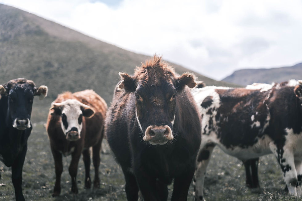
Mud…wherever you’re hiking you will encounter plenty of it. I only hike in trail runners but would have preferred hiking boots for this hike. Expect trails to be ripped up from livestock. Without hiking poles you’ll be struggling.
I’ve heard you can rent rubber boots from the Jeep drivers, if you’re just hiking round Cocora Valley this might not be a bad idea, otherwise not sure how well they’ll function for a backpacking trip.
When booking a guided trip, your best bet is to book in person or through your hotel. Booking online is guaranteed to be a much more expensive price then you’ll be quoted on site.
There are places you can rent gear all sorts of gear in Salento, you can take a look at this service on facebook. I met the owner and definitely specializes in helping trekkers who are looking to tailor their own adventure in the park.
Packing Tips
Weight means everything when backpacking. Leave all your spare clothes, shoes, laptop, etc. at your hostel in safe storage while you’re backpacking in Los Nevados.
You can get food at the huts however you’ll want to bring a comfortable amount of food. Get items like cheese, nuts, crackers, anything that will last a few days unrefrigerated and not have heavy packaging. Nothing is worse than not having snacks when you need on the trail.
A water filter should be a must-have. There are ample water sources and plenty of fresh glacier streams however there is too much free roaming livestock to not take proper precaution so filtering water should be a must.
Mentioned above but the mud is going to be tough to maneuver without a pair of trekking poles.
Count on rain, have dry bags and pack cover or waterproof pack to keep your shit dry!
See my Appalachian Trail gear which I use on all my treks and travel trips for an idea of what works!
Weather and Time of Year
This link above should give you an idea of the yearly climate in Los Nevados, which to say the least is not too varied. The weather is constantly changing due to the mountains and altitude and it’s never truly dry.
The driest months are December through February and then July though September. I hiked in October which is one of the wetter months and it was challenging however I’d rather take the trek than not as with most places.
The park is open year-round and most hikes can be done throughout the year.
Think of the weather as part of the experience and whatever you get will make for a photogenic and storytelling travel story.
Additional Resources
To get up to date information on the park, also be sure to check volcano activity since Nevado del Ruiz is an active volcano an has had catastrophic erruptions as recent as 1985.
A good resource for many predefined routes for the hikes discussed here.
I met Jacob while backpacking and he'll set you up with the right gear for your adventure
©Copyright 2020-2022 Secret Hike
Photography exclusively by Dan Oliver unless otherwise stated and cited. Embedded maps are provided by Embed Google Map (embedgooglemap.net) and map images shown are provided as stated and cited.
DISCLAIMER:
This website is provided for entertainment purposes only, and is not meant to serve as an instructional guide, or present itself as an authority for any of the locations written about. The locations mentioned, written, and photographed herein are nothing more than my personal adventure archive. If you are interested in visiting any locations you should not depend on the information in this website to plan any excursions. You should research a wide variety of informational sources, websites, hiking guide books and maps found elsewhere. Many locations are dangerous and potentially illegal to access which can lead to fines, injury or death even when prepared. I do not encourage anyone to trespass or put themselves or others in way of harm. This website, and therefore its’ owner/author, cannot assume any responsibility for anything you may incur while hiking or exploring any of these locations or anywhere on planet earth. Thank you for viewing!


Comments